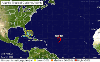
The big news tonight worth mentioning, news as in "new" is that there is a Yellow circle over the "Bahamas".... though it's really over South Florida,the Florida Straits, Bahamas and possibly parts of the Bermuda Triangle.
The discussion from the NHC is sort of nebulous. It is there, it's circled but it has a 0% chance of developing.
Often storms form at the bottom end of frontal boundaries or from an Upper Level Low that spins up or rather down to the surface. This is exactly the type of front that could cause such a system or quasi system to form. Yet, if they say zero chances ...will go with that.
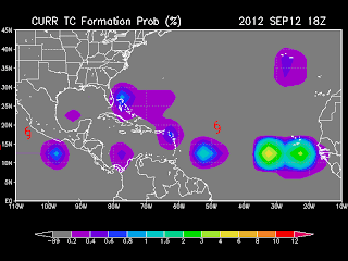
Note the map I showed this morning does show an area there of possible tropical cyclone formation.

Water temps would definitely support something...

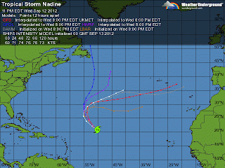
A footnote on Nadine worth mentioning... there's one model that broke from the pack

The GFDL takes Nadine up towards Newfoundland Leslie like... let's see if this trend continues...
Nicole looks pretty put togetherborderline Hurricane...just 5 mph from being a Hurricane

She should veer east as forecast... pretty storm to watch from a safe distance
Looks a lot like Azores or bust...
...except for that weird GFDL model.....
Anyway...that's all the weather news that is fit to print ...
Stay tuned... weather is always fluid so things change... often...
Sweet Tropical DreamsBobbi
Hiç yorum yok:
Yorum Gönder