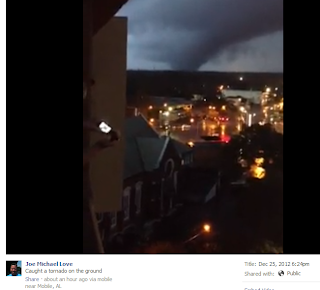
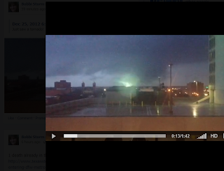
The Mobile Tornado has everyone talking. Not that often you have a wedge shaped tornado on the ground for a long time in a metropolitan city on Christmas Day.
Amazingly this was the second tornado to touchdown in Mobile in less than a week.
Texas also had tornadoes today as the first victim of this storm system died. A 25 year old man in a Houston suburb was killed when a tree fell on his pick up truck that he was riding this morning in Harris County.
http://www.chron.com/news/texas/article/Nasty-storms-blamed-1-death-make-travel-tough-4144131.php
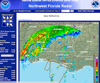
Notice the rain falling in South Carolina from the warm front that is associated with this system.
Note the freezing conditions in Arkansas.
The line of storms pushing through as warm, moist air is punching up into the heart of the cold weather creating dry lines, rotation and a memorable weather event on Christmas Day of 2012!
Live updates are being forecast from Accuweather:
http://www.accuweather.com/en/weather-video/video-arkansas-blizzard-conditions/655578741001
Several people caught the Mobile Tornado on their cell phones...
https://www.facebook.com/photo.php?v=4140595600830
You ABSOLUTELY must watch this video... real video with a real tornado not special effects.

Another great video from the same storm on Facebook:
https://www.facebook.com/photo.php?v=10200265647749842&set=vb.1412645710&type=2&theater

The power going out..flashes on air live... over 20,000 people without power in Mobile.
Ice Storm Warnings are up for parts of Virginia ...
http://woay.com/Alerts.aspx?aid=259
URGENT - WINTER WEATHER MESSAGE
NATIONAL WEATHER SERVICE CHARLESTON WV
419 AM EST TUE DEC 25 2012

...POTENTIAL FOR HEAVY ICE ACCUMULATIONS WEDNESDAY...

.A STRONG LOW PRESSURE SYSTEM WILL MOVE FROM THE WESTERN GULF
COAST NORTHEASTWARD...PASSING ACROSS OUR AREA LATER TUESDAY NIGHT
AND WEDNESDAY. THIS WILL BRING A WINTRY MIX OF PRECIPITATION TO
THE AREA...INCLUDING THE POTENTIAL FOR HEAVY ICE ACCUMULATIONS.

WVZ046-047-251730-
/O.UPG.KRLX.WS.A.0006.121226T0300Z-121227T1100Z/
/O.NEW.KRLX.IS.W.0001.121226T0300Z-121227T0000Z/
POCAHONTAS-RANDOLPH-
INCLUDING THE CITIES OF...MARLINTON...ELKINS
419 AM EST TUE DEC 25 2012
Virginia into Maryland will see ICE accumulations from this system.
There is damage being reported in Murphy High School in Mobile and the Field House is reportedly gone and minor damage throughout the campus.

http://www.mhspanthers.com/

Panama Beach has a tornado warning currently as the system moves east though as of yet to reports of tornado damage anywhere.

When I said ALL of Alabama was under the gun this morning I was not exaggerating.

I think that picture above says it all...and it is moving East and North East..towards Georgia and the Carolinas.
As I said earlier this morning... it's a tale of two and three and four storms...
Euclid the Elephant... pick a place and feel a different type of storm.

Stay safe and if you are in the Carolinas... it's headed that way tomorrow...
Check them out...they cover the area well..
Besos BobbiStorm... stay safe and stay informed. If you have a weather radio.. keep it on!
Hiç yorum yok:
Yorum Gönder